• Aumentar letra
  • Reducir letra
  • Aumentar Espaciado
  • Disminuir Espaciado
  • Escala de Grises
  • Contraste
  • Fuente Dislexia
  • Restablecer
  • Centro de relevo

Encuentra lo que necesitas en segundos. Explora, descubre y obtén respuestas rápidas. ¡Comienza tu búsqueda ahora!

Basic Course in Geographic Information Systems (GIS): Applications in Territorial...

Centro de Educación, Continua, Abierta y Virtual

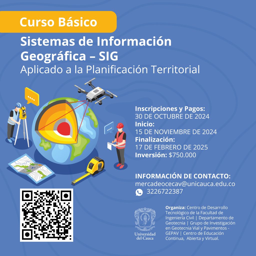
Basic Course in Geographic Information Systems (GIS): Applications in Territorial Planning

Event Date: November 15, 2024

Location: Virtual and in-person at the Tulcán Campus, Carrera 2 #15N Corner, Popayán, Cauca

Schedule: Monday, Tuesday, and Wednesday from 6:00 p.m. to 8:00 p.m.

  • Combined modality: In-person and virtual
  • Registration and Payment: Until October 30, 2024, or until all available spots are filled.
  • Duration: 60 hours of direct instruction – 40 hours of supervised asynchronous work.

Registration Link: [https://bit.ly/InscripcionesCECAV](https://bit.ly/InscripcionesCECAV)

A payment receipt will be sent to the email address provided after the registration process and data verification (on business days), once the minimum number of participants required to hold the academic event has been reached.

After the registration fee has been paid, refunds will only be granted for justified reasons and upon submission of a formal request using the institutional format at least five business days prior to the start date of the academic offering.

Cost: $750,000

Organized by: University of Cauca, with the participation of the Technological Development Center of the Faculty of Civil Engineering, the Department of Geotechnics, and the Geotechnics, Roads and Pavements Research Group – GEPAV. With the support of the Center for Continuing, Open and Virtual Education – CECAV

Target audience: Anyone interested in entering the world of Geographic Information Systems (GIS) by learning to use the most powerful and widely demanded desktop GIS software in the global job market, ArcGIS, as well as the most widely used open-source GIS software, QGIS. This is a basic-to-intermediate level course.


Course PDF File

Imagen de Curso Básico de Sistemas e Información Geográfica – SIG Aplicado a la Planificación Territorial
Provided Photo.

Institution with High Quality Accreditation for 8 years, resolution MEN 6218 of 2019 - Vigilada MinEducación

  • Aumentar letra
  • Reducir letra
  • Aumentar Espaciado
  • Disminuir Espaciado
  • Escala de Grises
  • Contraste
  • Fuente Dislexia
  • Agrandar Cursor
  • Resaltar Enlaces
  • Restablecer
  • Centro de relevo

Universidad del Cauca

NIT. 891500319-2

Address: Calle 5 # 4 - 70 | Popayan, Colombia

Telephone: +57 (602) 820 9900

Toll-free: 018000 949020

Requests, Complaints, Claims, Suggestions and Congratulations
Email: ventasreclamos@unicauca.edu.co

Judicial notifications
Email:processes@unicauca.edu.co

Follow us on:

Institution with High Quality Accreditation for 8 years, resolution MEN 6218 of 2019 - Vigilada MinEducación